
Start a journey with a drive pass
Makawao (Pass By) Drive past this quaint town with miles of greenery.
Kula (Pass By) Views of Kula – open country slopes, quaint & rustic. 3
Waikapu Enjoy a local-style, sit down breakfast. Locally and family owned, the Mill House provides an idyllic dining experience, situated at the old sugar mill amidst a peaceful, country landscape.
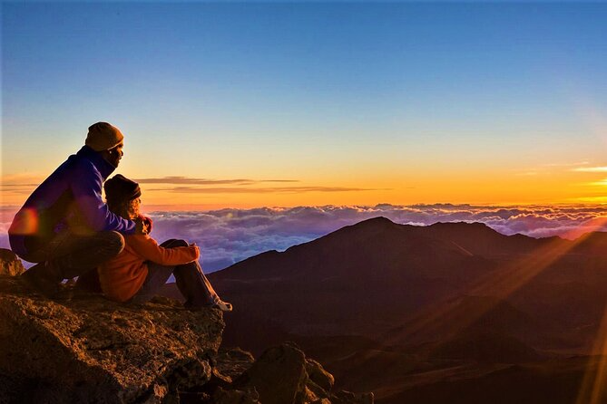
Haleakala Crater Home to the world’s largest dormant volcano; over 30,000 acres. The park is known for its endemic and rare flora and fauna, scenic drive and stunning views. Haleakalā volcano’s summit is a large erosional valley that formed after the rimrock lava flows were erupted around the top of the volcano about 145,000 years ago.
Haleakalā is Maui’s active volcano

East Maui volcano, known more widely as Haleakalā, is one of two volcanoes that make up the Island of Maui. It is in the postshield alkalic stage of Hawaiian volcanism and is the western-most volcano monitored by the Hawaiian Volcano Observatory.
East Maui began its growth about 2 million years ago, but its early history of volcanism is buried beneath innumerable lava flows thousands of meters thick. The oldest lava flow exposed on East Maui is about 1.1 million years in age and is a part of a sequence emplaced near the end of the shield-building stage. These lava flows are found along the north shore of the island from Honomanu Stream eastward to Nāhiku. This sequence of flows, the Honomanu Basalt, are named after a site where the lava flows are well exposed.
The postshield stage of volcanism began around 900,000 years ago at East Maui. Strata in the main part of this stage have been grouped into the Kula Volcanics, named for the upcountry town. In most places, lava flows of the Kula Volcanics extend from the coast to the summit area of Haleakalā, where they are well exposed in the walls of Haleakalā Crater. The ages obtained from Kula volcanic rocks indicate they span the period from 950,000 to 150,000 years ago.

Youngest postshield eruption products found along rift zones.
Geochemical analyses of products from East Maui show that volcanism remains in the postshield stage as eruptive vigor wanes. Strata in the youngest part of the postshield stage have been named the Hana Volcanics, after the town. Characteristic products include the young cinder cones and lava flows that blanket the floor of Haleakalā Crater, which were emplaced as recently as about 800 years ago. Lava flows and cinder cones younger than 500 years are found along Haleakalā’s southwest and east coasts and along the corresponding major rift zones of the volcano. The east rift zone extends into the ocean at the village of Hana, ending a short distance eastward. The youngest lava flow, Kalua o Lapa, erupted from East Maui’s lower southwest rift zone sometime between A.D. 1420 and 1620.
Haleakalā’s Crater formed by erosion, not collapse.
Haleakalā volcano’s summit is a large erosional valley that formed after the rimrock lava flows were erupted around the top of the volcano about 145,000 years ago. Two large valleys, Ko‘olau to the north and Kaupō to the south, expanded into the summit area along the main rift zone and coalesced to form the summit crater. The south flank Kaupō Gap probably originated when a large section of the mountain slid southward. Evidence is found in sea cliffs located about 9 km (6 mi) south of the crater, which expose a massive debris-avalanche deposit that is overlain by a 120,000-year-old lava flow. Geologic deposits suggest the formation of East Maui’s north-flank Ko‘olau Gap probably formed over, perhaps, tens of thousands of years as many small landslides gave way and were carved down by streams. The deposits of reworked debris are found as thick sand and gravel at the mouth of Ke‘anae Valley before a 43,000-lava flow made its way down the canyon from Haleakalā Crater.
The exact timing of crater formation is hard to determine, because the process of erosion destroys the record of valley deepening and widening. It is likely that the crater grew larger in stages.


Geologic mapping reveals youth of lava in Haleakalā Crater

A geologic map showing the specific area of Haleakalā Crater, by Gordon A. Macdonald, was published by the U.S. Geological Survey in 1978. A state-wide geologic map was published in 2007, and radiocarbon ages obtained as part of the mapping were the first reported from volcanic deposits in Haleakalā Crater. The new radiocarbon ages range from about 4,000 to 900 years ago. None of the crater-floor deposits are younger than about 800 years in age, an estimate drawn from the stratigraphic setting of the dated lava flows and the extent of weathering in undated lava. Elsewhere on the volcano, however, younger lava flows remind us that the volcano erupts several times per thousand years.
The youngest age obtained, about 870 years ago, is from one of several lava flows that were erupted from a fissure system on the north crater wall below Hanakauhi Peak. These Hanakauhi fissure flows poured down the north wall and then flowed east toward Kaupō Gap. They are crossed today by the trail leading from Hōlua to Palikū. The Hanakauhi eruption is the youngest volcanism in the eastern half of the crater.
Probably the youngest volcanic feature in the western crater area is Ka Lu‘u o ka ‘Ō‘ō, a sharp-rimmed cinder conethat lies downslope from the summit visitor center. Its lavaflows overlie the 970-yr Hōlua lava flows but are roughly similar in age, probably within a few tens of years. A trail to the top of Ka Lu‘u o ka ‘Ō‘ō can be reached from the summit visitor center.
Eruptions from East Maui will occur again.
Although another 500 years or more may pass before Haleakalā becomes restless, it’s also possible that new eruptions will begin in our lifetimes. We can better understand the precursory phenomena if we track the pattern of the volcano in repose. For these reasons, the U.S. Geological Survey maintains a sparse seismic network on Haleakalā volcano. Also we conduct surveys periodically, using GPS receivers that gather data about the volcano’s surface deformation or lack thereof.